

Pyrénées National Park
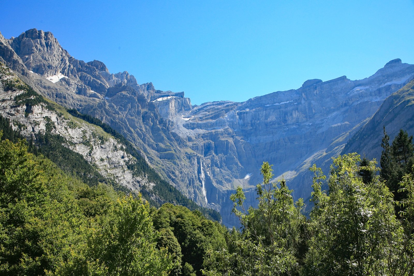
A 100 km strip of high mountains along the Spanish border, from the vallée d’Aspe to the vallée d’Aure: the cirque de Gavarnie, the Vignemale at 3,298 m, isards and the brown bear’s last stronghold in the Aspe forests.
- 176 mi²Area
- 3,501 ft to 10,820 ftElevation
- 1967Established
At a glance
- Part of the Pyrénées-Mont Perdu UNESCO World Heritage property since 1997, for nature and culture
- The Grande Cascade de Gavarnie falls 423 m, the highest waterfall in France
- From 1,067 m to 3,298 m at the Pique Longue du Vignemale, highest summit of the French Pyrenees
- More than 2,500 higher plant species, over 40% of mainland France’s plant diversity on 0.5% of its territory
- Dogs are banned in the core, even on a lead, except on a few listed roads and paths
- No swimming or other immersion in the lakes and pools of the core
Where to stay
Hotels, guesthouses and rentals around Pyrénées National Park
Check availability with our partners
Affiliate links: if you book through them, we earn a commission. The price you pay does not change. How this site is funded
Mountain huts
Refuge d'Arlet
6,516 ft · 43 beds
Refuge d'Arrémoulit
7,431 ft · 44 beds
Run by Club alpin français de Pau
Refuge d'Ayous
6,496 ft · 47 beds
Refuge d’Ilhéou
6,522 ft · 22 beds
Run by Commission syndicale de la vallée de Saint-Savin
Refuge de Bayssellance
8,698 ft · 58 beds
Run by Club alpin français de Bordeaux
Refuge de la Brèche de Roland
8,488 ft · 57 beds
Run by Club alpin français de Tarbes
Refuge de Migouélou
7,474 ft · 34 beds
Refuge de Pombie
6,667 ft · 61 beds
Run by Club alpin français de Pau
Refuge des Espuguettes
6,650 ft · 54 beds
See 2 more huts
Refuge du Larribet
6,798 ft · 60 beds
Run by Club alpin français de Lourdes
Refuge Wallon Marcadau
6,119 ft · 113 beds
Run by Commission syndicale de la vallée de Saint-Savin
Nearby villages and towns
CauteretsClosest
5.6 mi as the crow flies
See hotelsGavarnie-Gèdre
11 mi as the crow flies
Also close to Ordesa y Monte Perdido National Park
See hotelsLaruns
17 mi as the crow flies
See hotelsLourdes
19 mi as the crow flies
See hotels
How the visit runs
Luz-Gavarnie and its three cirques
Along 23 km of frontier ridge, the valley holds the highest summits of the Pyrenees and the cirques of Gavarnie, Estaubé and Troumouse. From the col des Tentes, the road closes at 2,200 m and continues for 810 m as a 1.8 m wide path open to all, facing the cirque and the Brèche de Roland.
Cauterets, the Pont d’Espagne and the lac de Gaube
The Pont d’Espagne, 7 km from Cauterets, is reached by the chemin des cascades from the Raillère car park in 1 h 30. From the Puntas car park, a path or the lifts lead on to the lac de Gaube under the Vignemale.
The vallée d’Ossau
From Laruns, the valley climbs to the col du Pourtalet under the pic du Midi d’Ossau. The lacs d’Ayous loop starts from the Bious-Artigues car parks (14 km, about 5 h), and the tour of the Ossau (15 km, 1,200 m of ascent) is for strong walkers.
The vallée d’Aure and the Néouvielle
The best-known entrance to the Néouvielle is the lac d’Orédon, by the Aragnouet road to a car park at 1,900 m; shuttles are compulsory there and at Cap de Long in July and August. Barèges and La Mongie are the other gateways, and the valley also holds the cirque de Barroude.
The vallée d’Aspe
The westernmost valley winds for nearly 30 km from Escot to the col du Somport, on the chemin de Saint-Jacques (Way of St James). The chemin de la Mâture, cut into a cliff from 1766 over 1.2 km, and the fort du Portalet, open to the public, are its landmarks.
The val d’Azun
The valleys of Arrens-Marsous, Estaing and the Ouzom, under the Balaïtous (3,144 m). Arrens-Marsous is the start of the GR10 crossing of the Hautes-Pyrénées, 10 to 12 stages (160 km) to the Granges d’Astau.
Classic outings from the road
| Outing | Start | Distance and climb | Time |
|---|---|---|---|
| Brèche de Roland (2,807 m) | Col des Tentes (2,207 m) | 11 km there and back, 584 m of ascent | about 5 h 30 |
| Lacs d’Ayous loop | Bious-Artigues car parks | 14 km | about 5 h |
| Tour of the Ossau, by the col de Suzon, the Pombie refuge and the col de Peyreget | Bious-Artigues car park | 15 km, 1,200 m of ascent | For strong walkers |
| Cirque de Gavarnie and the Piméné (2,801 m) | Gavarnie | 20.9 km, 1,430 m of ascent | 2 days, with a night at the Espuguettes refuge (2,027 m, 54 places) |
Source: Rando Vallées de Gavarnie and Office de tourisme Vallée d’Ossau, route sheets (read October 2026). The Piméné loop is advised from late June to late September.
Before you go
- Bivouac: more than one hour’s walk from the edge of the core or any motor access; the tent goes up after 7pm and comes down before 9am. Marked bivouac areas surround some refuges. Camping, in a tent, a vehicle or a camper van, is banned in the core, car parks included.
- Lakes and streams: swimming and any activity involving immersion are banned in the lakes and pools of the core; river walking is banned in streams, canoeing and canyoning are regulated.
- Fire: a fire with a hearth is strictly banned; self-contained portable stoves are allowed under the park’s rules.
- Drones: the park accepts no waiver request for leisure drones over the core.
- Picking plants, berries included, is banned in the core, as is taking fossils, minerals or animals.
- Lighting: portable lamps are allowed up to 500 lumens.
- Refuges are open to all and generally staffed in summer and some periods of spring; book nights and meals. In summer they carry defibrillators, and they have a radio telephone for rescue. The emergency number is 112.
- Snow: avoid snowfields and above all snow bridges. On the Brèche de Roland, snow often stays until the end of July, and crampons and an ice axe may be needed late into summer.
- Pacing: an average walker climbs 300 m an hour and descends 500 m; height gain matters more than distance.
What is allowed
| Topic | Rule | Source |
|---|---|---|
| Wild camping (bivouac) | Restricted | Parc national des Pyrénées |
| Camping | Not allowed | Parc national des Pyrénées |
| Fires | Not allowed | Parc national des Pyrénées |
| Dogs | Not allowed | Parc national des Pyrénées |
| Photography | Restricted | Parc national des Pyrénées |
| Drones | Not allowed | Parc national des Pyrénées |
| Swimming | Not allowed | Parc national des Pyrénées |
| Cycling | Restricted | Parc national des Pyrénées |
| Motor vehicles | Restricted | Parc national des Pyrénées |
| Picking plants | Not allowed | Parc national des Pyrénées |
| Fishing | Restricted | Parc national des Pyrénées |
| Hunting | Not allowed | Parc national des Pyrénées |
Rules checked with the site manager on October 7, 2026. They can change at short notice: check before you go.
When to go
- Busiest period July to August
How to get there
Pyrénées National ParkPlaces to stay in the parkGateway towns
- Raillère car park, above Cauterets1 h 30Pyrénées National Park
To the Pont d’Espagne by the chemin des cascades.
- Puntas car parkabout 20 minPyrénées National Park
To the lac de Gaube by the Puntas gondola and the Gaube chairlift, then a 15-minute flat walk.
- Puntas car parkabout 1 h 15Pyrénées National Park
Climb to the lac de Gaube (1,730 m) by the GR10, according to N’PY, the site’s operator; 4.9 km there and back.
Combine in the same day
Ordesa y Monte Perdido National Park is 16 mi away. Staying in Gavarnie-Gèdre puts both within easy reach.
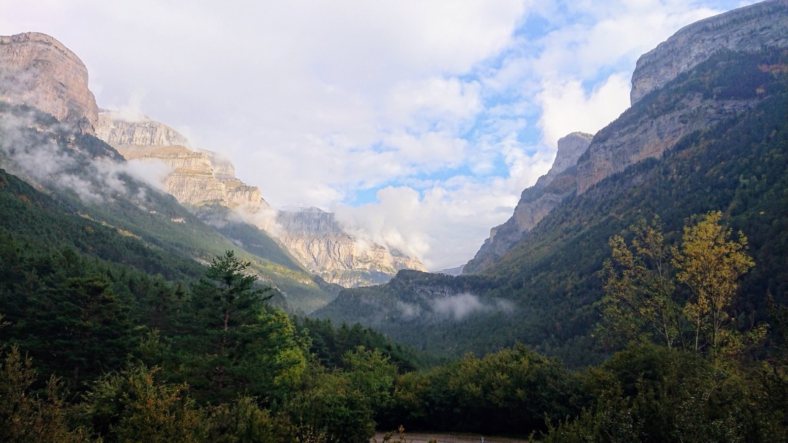
Created by decree on 23 March 1967 as the third national park in France, the Pyrénées park runs for 62 mi along the frontier ridge with Spain, across six valleys from the vallée d’Aspe to the vallée d’Aure. Its core is narrow, between 0.8 and 6.2 mi wide, and never drops below 3,501 ft: a perimeter that, in the park’s own words, mixes ecological and political logic.
Two zones make up the park:
- The core: 45,707 ha over fifteen communes, six in Béarn and nine in Bigorre, with no permanent inhabitant. Local authorities own 97% of it, and land for the flocks takes up nearly 90% (40,000 ha), so grazing and forestry carry on inside.
- The area of adhesion: 149,829 ha, where 67 communes have signed the charter.
- On the ground, a red isard head on a white background marks the edge of the core.
Two plates, then the glaciers: Gavarnie, Ossau and the Néouvielle
The Pyrenees rose at the start of the Tertiary era, when the Iberian plate collided with the European plate. The heart of the chain is granite and metamorphic rock, its edges limestone and sandstone, and glacial erosion carved the great north to south valleys.
The cirque de Gavarnie is the clearest result, and the highest limestone cliff in Europe:
- a glacial wall 4,265 ft high at its centre and about 4,921 ft at its highest point, below the Marboré (10,656 ft);
- three tiers, with a circumference of about 4 mi at the base;
- the Grande Cascade, source of the gave de Pau.
Two other landscapes stand apart:
- In the west, the vallée d’Ossau runs for 31 mi to the Spanish border at the col du Pourtalet, under the pic du Midi d’Ossau (9,462 ft), a former volcano.
- In the east, the Néouvielle national nature reserve, created in 1936 and managed by the park, rises from 1,800 to 10,141 ft, holds 70 lakes and has the highest mountain pines in Europe, with a record at 8,530 ft.
A border shared with Ordesa y Monte Perdido
The park shares 9.3 mi of border with its Spanish counterpart, Ordesa y Monte Perdido, created in 1918; national hunting reserves and the rio Ara biosphere reserve complete the Spanish side. Since 1997 the property Pyrénées-Mont Perdu has been on the UNESCO World Heritage list for both nature and culture, around the Mont Perdu:
- in France, the glacial cirques of Gavarnie, Estaubé, Troumouse and Barroude;
- in Spain, the canyons of Anisclo, Ordesa, Escuain and Pineta.
A joint Franco-Spanish committee runs the property. Its pastoral culture rests on the Lies et Passeries treaties, still in force, which guarantee the free movement of goods and people between valleys. Walkers cross the border too:
- The Haute Route Pyrénéenne, traced by Georges Véron in the 1970s, swings between France and Spain along ridges and high passes.
- The GR10 runs about 621 mi from Hendaye to Banyuls, a 45 to 60 day walk that many do in sections.
Isards, bears and the Pyrenean desman
The fauna list reads like a Pyrenean catalogue:
- isards and reintroduced marmots;
- the bearded vulture, griffon and Egyptian vultures, golden eagle and western capercaillie;
- the Pyrenean desman;
- the brown bear, whose last stronghold is the forests of the vallée d’Aspe;
- some forty endemic invertebrate species.
The park also manages the national nature reserve of the vultures of Ossau, 83 ha. Among the plants, it counts part of the 160 or so endemics of the Pyrenean-Cantabrian massif, such as the ramonde des Pyrénées and the Pyrenean lily.
At night, the sky is protected too: the park co-manages the Pic du Midi international dark sky reserve, recognised since 2013, from where the whole constellation of Scorpius can be seen in summer.
Frequently asked questions
Can you wild camp in Pyrénées National Park?
Not camping, but bivouac is allowed: more than one hour’s walk from the edge of the core or any motor access, with the tent pitched after 7pm and struck before 9am.
Are dogs allowed in Pyrénées National Park?
No, not in the core, even on a lead. Herding dogs, guide and assistance dogs and avalanche dogs on duty are exceptions, and dogs on a lead are accepted on a few listed roads and paths, such as the path from Gavarnie to the hôtel du Cirque and, in summer, the path from the upper station of the Gaube chairlift to the hotel at the lac de Gaube.
Can you swim in the lac de Gaube?
No. Swimming and water activities involving immersion are banned in all the lakes of the core, the lac de Gaube included.
How do you get to the lac de Gaube?
On foot, about 2 h 30 there and back (4.9 km, 259 m of ascent) from the Puntas car park, or by the Puntas gondola and Gaube chairlift (about 20 minutes) followed by a 15-minute flat walk. In 2026 the lifts ran every day from 14 May to 27 September, 9am to 5pm, with a pedestrian pass that includes parking; check the operator for the dates of later seasons.
How long is the hike to the Brèche de Roland?
About 5 h 30 for 11 km there and back from the col des Tentes (2,207 m), graded difficult. The breach, at 2,807 m, gives an unusual view over Spain’s Ordesa y Monte Perdido national park.
When does the Gavarnie waterfall have the most water?
Around June, when the snowmelt gives the Grande Cascade its highest flow. In winter and early spring it freezes completely.
How do you get to the Pyrénées National Park by train?
Through the stations of Pau, Oloron, Tarbes, Lourdes and Lannemezan, with coaches on to the valleys. The nearest airports are Tarbes-Lourdes-Pyrénées and Pau-Pyrénées.
Can you fly a drone in Pyrénées National Park?
No. The park accepts no waiver request for leisure drones over the core, and motorised flight below 1,000 m is banned unless the park’s director grants a waiver, for example for science, supplying refuges or authorised works.
Sources
11 sources
- Esprit parc national (Parcs nationaux de France) consulted on October 7, 2026
- N'PY (Grand Tourmalet, exploitant de la route des lacs) consulted on October 7, 2026
- Parc national des Pyrénées consulted on October 7, 2026
- Atout France (France.fr) consulted on October 7, 2026
- Rando Vallées de Gavarnie (Pays Toy / Vallées de Gavarnie) consulted on October 7, 2026
- OpenStreetMap consulted on October 7, 2026
- Wikidata consulted on October 7, 2026
- Wikipedia (de) consulted on October 7, 2026
- Wikipedia (en) consulted on October 7, 2026
- Wikipedia (es) consulted on October 7, 2026
- Wikipedia (fr) consulted on October 7, 2026