

Picos de Europa National Park
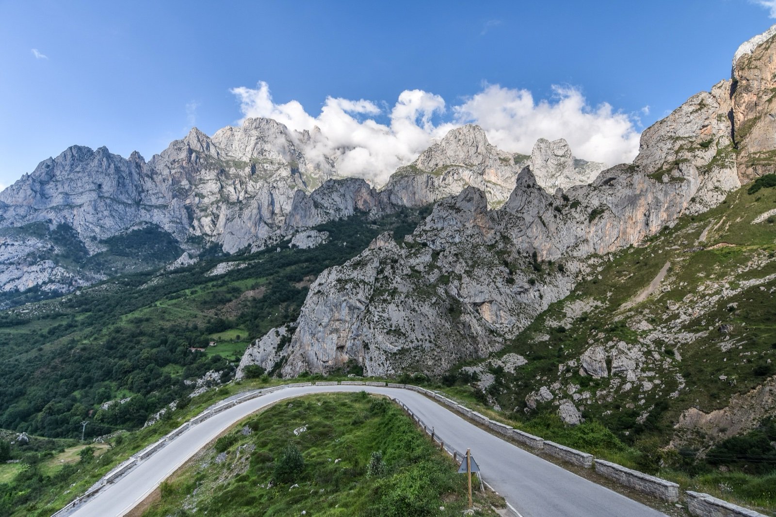
Three limestone massifs shared by Asturias, Cantabria and Castilla y León, rising from 75 m in the Deva valley to 2,648 m at Torre Cerredo, with the Cares gorge and the Lakes of Covadonga.
- 260 mi²Area
- 246 ft to 8,688 ftElevation
- 1918Established
- 1.6 millionVisitors in 2025
At a glance
- Heir to Spain’s first national park, the Montaña de Covadonga, declared on 22 July 1918
- 674.55 km² across Asturias, Cantabria and Castilla y León, Spain’s second-largest national park
- From 75 m in the Deva valley to 2,648 m at Torre Cerredo, in a small area
- Almost the only Spanish national park with residents: 20 villages inside
- 1,565,899 visitors in 2025, third in Spain’s national park network
- Wild camping banned: bivouac without a tent only above 1,800 m, on a crossing
Where to stay
Hotels, guesthouses and rentals around Picos de Europa National Park
Check availability with our partners
Affiliate links: if you book through them, we earn a commission. The price you pay does not change. How this site is funded
Mountain huts
- Refugio de Cabaña Verónica
- Refugio de Collado Jermoso
- Refugio de Ándara
- Refugio de Vegabaño
- Refugio de Vegarredonda
- Refugio Jou de los Cabrones
- Refugio de La Terenosa
- Refugio de Vega de Ario
- Refugio de Vega de Urriellu
Nearby villages and towns
PotesClosest
12 mi as the crow flies
See hotelsCangas de Onís
17 mi as the crow flies
See hotels
How the visit runs
Cangas de Onís and the Lakes of Covadonga
The Asturian gateway, reached from Oviedo by the N-634 to Arriondas and the N-625. From Cangas de Onís, the AS-262 and then the CO-4 climb to the lakes of Enol and La Ercina, by bus only on regulation days. The Pedro Pidal visitor centre stands by the lakes.
Poncebos, Caín and the Cares gorge
The Senda del Cares starts at Poncebos on the Asturian side and at Caín on the León side. Poncebos is also the lower station of the Bulnes funicular.
Sotres, for the Naranjo de Bulnes
Sotres is the start of the most used approach on foot to the Urriellu, the Naranjo de Bulnes.
Potes and Fuente Dé
From Santander, the A-8 to Unquera and the N-621 by Panes lead to Potes, gateway to the Cantabrian side. At Fuente Dé, a cable car at the foot of Peña Vieja climbs nearly 1,000 m in a few minutes; the Sotama visitor centre is at Tama, in Cillórigo de Liébana.
Valdeón and Sajambre, from León
The León side is reached through Riaño, by the N-625 or the N-621, and holds the two valleys of Valdeón and Sajambre.
Five gateways to the three massifs
| Gateway | Side | Road in | Starting point for |
|---|---|---|---|
| Cangas de Onís | Asturias | From Oviedo: N-634 to Arriondas, then N-625 | The AS-262 and CO-4 to the lakes of Enol and La Ercina |
| Poncebos | Asturias | The Senda del Cares; the Bulnes funicular | |
| Sotres | The most used approach on foot to the Urriellu (Naranjo de Bulnes) | ||
| Potes | Cantabria | From Santander: A-8 to Unquera, then N-621 by Panes | Fuente Dé and its cable car |
| Riaño | León | N-625 or N-621 | The Valdeón and Sajambre valleys; Caín, the León start of the Senda del Cares |
Source: Picos de Europa National Park, “Prepara tu visita” page (2026).
Two visitor centres, two timetables
| Centre | Where | Hours | Closed |
|---|---|---|---|
| Pedro Pidal | By the Lakes of Covadonga | 10:00 to 17:30; daily from 1 June to 12 October 2026, otherwise only on set dates published by the park | |
| Sotama | Tama, Cillórigo de Liébana | 9:00 to 20:00 from 1 April to 31 October; 9:00 to 15:00 from 1 November to 31 March | 22 December to 6 January |
Source: Picos de Europa National Park, visitor centres page (2026).
Before you go
- Lakes of Covadonga by bus: on regulation days (Holy Week, summer, national long weekends), within a season that opens on 28 March and runs to the Constitution long weekend in December, with periods set each year, private cars are excluded 24 hours a day; tickets are sold on the website of the operator, ALSA.
- Bivouac: sleeping in the open without a tent only above 1,800 m, on a crossing, three nights at most in one place for mountaineering and climbing. A tent only above 1,800 m, in bad weather or force majeure, pitched no earlier than an hour before sunset and taken down within an hour after sunrise. Organised groups of more than 10 need permission.
- Fire is banned by environmental protection rules.
- Drones: the park places an absolute restriction on them and allows them only for management and authorised research. Flying below 3,000 m above the ground is banned without express authorisation; paragliders, hang-gliders, kites and balloons are banned too.
- Water: fountains outside the villages are not sanitary-controlled. Bring bottled water, and avoid fountains in low areas or near livestock.
- Dogs stay on a lead; on the Ruta del Cares, extending leads are banned and a fixed lead may be 1.20 m at most.
- Children under eight should never walk the paths without holding an adult’s hand, and are best kept off any difficult route.
- Mountain bikes only on tracks open to motor vehicles; they are banned on the Senda del Cares, the Senda del Arcediano and the Urdón path.
- Mobile signal is limited in the park, but emergency calls to 112 get through over much of it.
What is allowed
| Topic | Rule | Source |
|---|---|---|
| Wild camping (bivouac) | Restricted | Parque Nacional Picos de Europa |
| Camping | Not allowed | Parque Nacional Picos de Europa |
| Fires | Not allowed | Parque Nacional Picos de Europa |
| Dogs | Restricted | Parque Nacional Picos de Europa |
| Photography | Restricted | Parque Nacional Picos de Europa |
| Drones | Not allowed | Parque Nacional Picos de Europa |
| Swimming | Not allowed | Parque Nacional Picos de Europa |
| Cycling | Restricted | Parque Nacional Picos de Europa |
| Motor vehicles | Restricted | Parque Nacional Picos de Europa |
| Picking plants | Not allowed | Parque Nacional Picos de Europa |
| Fishing | Not allowed | Parque Nacional Picos de Europa |
| Hunting | Not allowed | Parque Nacional Picos de Europa |
| Visitor quota | RestrictedMarch to December | Parque Nacional Picos de Europa |
Rules checked with the site manager on October 8, 2026. They can change at short notice: check before you go.
When to go
- Busiest period July to September
How to get there
Picos de Europa National ParkPlaces to stay in the parkGateway towns
On 22 July 1918 the Peña Santa massif became the Parque Nacional de la Montaña de Covadonga, the first national park in Spain, declared for the twelfth centenary of the battle of Covadonga. Its promoter was Pedro Pidal, Marquis of Villaviciosa de Asturias, rapporteur of the law of 1916. Covadonga itself is where the Astures of Don Pelayo defeated a Muslim army in the 8th century, the start of the Reconquista.
The park has changed shape and status since:
- 30 May 1995: the Cortes Generales extend it to all three massifs.
- 1 February 2011: an inter-regional consortium takes over, with one co-director for each autonomous community and a presidency that rotates every year.
- February 2015: a further extension adds the municipality of Peñamellera Alta. The result covers 67,455 ha, the second-largest national park in Spain after the Sierra Nevada.
- 5 December 2020: sport hunting and recreational fishing end.
It is almost the only Spanish national park with people living inside it: 20 villages, 6 in Asturias, 2 in Cantabria and 12 in León, home to 1,157 inhabitants in 2013. Eleven municipalities share the park, and three of them, Oseja de Sajambre, Posada de Valdeón and Tresviso, lie entirely within it.
Cornión, Urrieles and Ándara: three massifs with no rivers on top
The park spans three massifs, all limestone, laid down in the Carboniferous when up to 3,281 ft of calcareous sediment built up:
- Cornión, the western massif.
- Urrieles, the Central massif.
- Ándara, the eastern massif.
On the high ground there are no surface streams at all: water sinks into an underground network and resurfaces in springs that feed the rivers.
Gorges, ice and cold
- From the Tertiary onwards, erosion cut the deep gorges of the Cares, the Sella, the Dobra and the Deva.
- Ice did the rest. The ice cap of the Cornión was the largest glacial system in the Cantabrian range, and around the Lakes of Covadonga lies the most important set of frontal moraines visible today.
- Winters can still be severe: Vega de Liordes, in Posada de Valdeón, recorded a low of −35.8 °C on 7 January 2021.
From 2.2 million visitors in 2004 to 1.57 million in 2025
The manager’s own figures trace the curve:
- 2004: more than 2,200,000 visitors.
- 2012: a historic low of 1,566,000, during the economic crisis.
- 2014: nearly 1,850,000.
- 2025: 1,565,899 in the official estimate, the third-highest in Spain’s national park network after the Teide (5.1 million) and the Sierra de Guadarrama (2.37 million).
Rockfall, fog and caves: safety in the Picos
The park reopened the Ruta del Cares after a rockfall, and warns that the risk remains, higher on rainy or windy days and just after them. At altitude, thick fogs called encainadas are frequent even in summer, and AEMET monitors the avalanche risk. The park’s advice:
- Avoid going out alone, or at least tell someone your route.
- Carry mountain gear, a lamp and a whistle.
Mines and caves
- In the Ándara massif, old mining pits and gallery vents are a hazard.
- Entering the Peñacastil ice cave and walking on its ice are banned, because of the risk of falling into a shaft, with fines that can exceed €3,000.
- Every cave in the park needs express authorisation.
For the conditions of the day, check with the park before setting out.
Frequently asked questions
Can you wild camp in the Picos de Europa?
No. Camping is allowed only at authorised campsites and next to villages with the owner’s consent. Sleeping in the open without a tent is allowed only when a crossing of the massifs catches you by night above 1,800 m, for at most three nights in one place.
Can you drive to the Lakes of Covadonga?
Not on regulation days (Holy Week, summer and national long weekends), when access is by ALSA bus only. The rest of the year the road is open to cars, though it can be closed when saturated; coaches must use the Buferrera car park.
Which regions is the Picos de Europa in?
Three autonomous communities: Asturias, Cantabria and Castilla y León, over eleven municipalities. Cangas de Onís is the Asturian gateway and Potes the Cantabrian one.
Can you swim in the rivers and lakes of the Picos de Europa?
No, except in signposted bathing areas near the villages. Canyoning, canoeing, rafting and hydrospeed are also banned without exceptional permission.
Are dogs allowed on the Ruta del Cares?
Yes, on a fixed lead no longer than 1.20 m; extending leads are banned on the route.
Can you fly a drone in Picos de Europa National Park?
No, with very few exceptions. The park places an absolute restriction on drones and allows them only for management and authorised research. National parks cannot be overflown below 3,000 m above the ground unless expressly authorised.
Are there free guided walks in the Picos de Europa?
In summer 2025 there were, from 1 July to 30 September: twelve outings a week, 15 people at most per walk, booked through the national parks reservation centre, with dogs discouraged. Check the park’s website for later summers.
Is the Covadonga sanctuary open on regulation days?
Yes. Access to the sanctuary of Covadonga is free all year, subject to parking space on the busiest days.
Sources
5 sources
- Parque Nacional Picos de Europa consulted on October 21, 2026
- MITECO Organismo Autónomo Parques Nacionales consulted on October 20, 2026
- OpenStreetMap consulted on October 8, 2026
- Wikidata consulted on October 8, 2026
- Wikipedia consulted on October 8, 2026