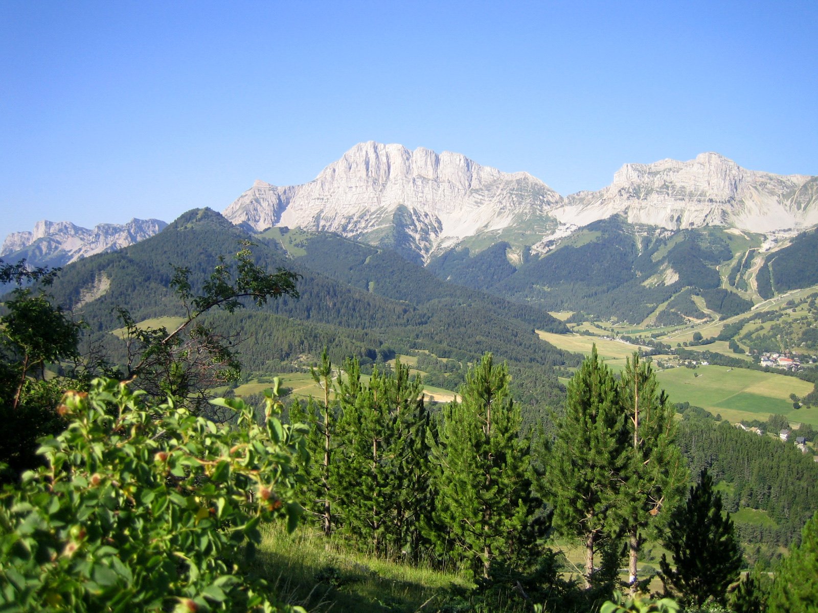
Vercors Regional Natural Park
A limestone massif between the Drôme and the Isère, rising to 2,453 m at the Rocher Rond, with 4,600 km of waymarked trails and the largest land nature reserve in metropolitan France.
- 879 mi²Area
- 8,048 ftElevation
- 1970Established
At a glance
- 227,621 hectares over 98 communes of the Drôme and the Isère, 70% of it forest
- The Hauts-Plateaux reserve, 17,030 ha: the largest land nature reserve in metropolitan France
- 4,600 km of waymarked routes and some fifty unstaffed huts, most of them free to use
- All four vulture species observable in France, with the bearded vulture reintroduced since 2010
- An International Dark Sky Reserve since July 2023, the fifth in France, over 1,600 km²
- Highest point: the Rocher Rond, 2,453 m, in the Drôme; the Grand Veymont tops the Isère side at 2,341 m
Where to stay
Hotels, guesthouses and rentals around Vercors Regional Natural Park
Check availability with our partners
Affiliate links: if you book through them, we earn a commission. The price you pay does not change. How this site is funded
Saint-MarcellinClosest
17 mi as the crow flies
See hotelsMens
17 mi as the crow flies
See hotelsVinay
20 mi as the crow flies
See hotelsRomans-sur-Isère
21 mi as the crow flies
See hotelsGrenoble
23 mi as the crow flies
See hotelsCrest
24 mi as the crow flies
See hotels
How the visit runs
Grenoble and the five other gateway towns
Crest, Grenoble, Mens, Romans-sur-Isère, Saint-Marcellin and Vinay lie outside the park but serve as its entrances; their tourist offices handle visitor information, since the Maison du Parc does not.
Villard-de-Lans and Corrençon
From Grenoble, regional coaches T64 and T65 climb to Villard-de-Lans and Corrençon-en-Vercors; in winter the Transaltitude service links Grenoble or Valence TGV station to Villard-de-Lans.
The Hauts-Plateaux nature reserve 1,050 to 2,341 m
No road and no permanent home cross it. Waymarking is limited to the GR 91/93 and the central path, with 7 self-managed shelters for walkers.
Vassieux-en-Vercors
Two museums run by the park: the Mémorial de la Résistance en Vercors, opened in 1994, and the musée de la Préhistoire, opened in 1980.
The Diois, on the southern side Grenoble to Die by train: 2 h 41 at the quickest
The cirque d’Archiane, the montagne de Glandasse and the cliffs of Glandage hold griffon and bearded vultures; climbing routes there follow the nesting restrictions mapped by the park.
Three species brought back to the Vercors
| Species | Reintroduced | Since then |
|---|---|---|
| Alpine ibex | 1989 | |
| Griffon vulture | 1999 | Nests on the Diois cliffs |
| Bearded vulture | 2010 | First breeding in 2022 |
Source: Parc naturel régional du Vercors, history and Diois climbing pages (read October 2026).
Before you go
- Dogs: banned all year in the Hauts-Plateaux reserve, even on a lead (fine of €135); elsewhere usually allowed on a lead, but not on the Ambel plateau or the Font d’Urle pasture from 1 June to 30 October.
- Bivouac: in the reserve from 5pm to 9am, near the shelters if possible; elsewhere the park recommends asking the landowner’s permission, and not staying several days in the same spot.
- Fire: prefectoral orders in the Drôme and the Isère forbid it; outdoor fires are banned all year in the reserve.
- Drones and paragliders: flying below 300 m over the reserve is forbidden, and so is taking off from it.
- Mountain bikes: in the reserve, only on the waymarked GTV VTT, the Coinchette loop and the col de Papavet.
- Water: carry enough to be self-sufficient and leave the troughs to the flocks; on the high plateaus surface water is rare and springs dry up.
- Navigation: bring a map and a compass or GPS for the reserve, where phone coverage is patchy and snow can complicate progress for much of the year.
- Guardian dogs: keep your distance, walk round the flock, get off your bike and do not look the dog in the eyes.
- Plants: picking is regulated for some species; the park suggests a photograph instead.
What is allowed
| Topic | Rule | Source |
|---|---|---|
| Wild camping (bivouac) | Restricted | Parc naturel régional du Vercors |
| Fires | Not allowed | Parc naturel régional du Vercors |
| Dogs | Restricted | Parc naturel régional du Vercors |
| Drones | Restricted | Parc naturel régional du Vercors |
| Cycling | Restricted | Parc naturel régional du Vercors |
| Picking plants | Restricted | Parc naturel régional du Vercors |
Rules checked with the site manager on October 16, 2026. They can change at short notice: check before you go.
When to go
- Access restricted on some days November to August
How to get there
Vercors Regional Natural ParkGateway towns
- Paris2 h 59 at the quickestVercors Regional Natural Park
To Grenoble, 4 h on average, 20 trains a day (SNCF Connect, read October 2026); Paris to Valence takes 2 h 07 at the quickest.
- Lyon1 h 23 at the quickestVercors Regional Natural Park
To Grenoble, 1 h 30 on average, 19 trains a day (SNCF Connect, read October 2026).
- Marseille2 h 24 at the quickestVercors Regional Natural Park
To Grenoble, 3 h 33 on average, 20 trains a day (SNCF Connect, read October 2026).
- Grenoble2 h 41 at the quickestVercors Regional Natural Park
To Die, on the southern Diois side, 5 trains a day (SNCF Connect, read October 2026).
The Vercors was one of the first ten regional natural parks in France, created in 1970, and a decree signed by the Prime Minister on 26 March 2025 renewed its classification for the 2025-2040 charter.
The park itself has no regulatory power: it works by persuasion. The rules a visitor meets come from the local authorities, the prefectures and, on the high plateaus, the national nature reserve that the park manages.
Ninety-eight communes from the Royans to the Trièves
This is a mid-mountain massif shared between the Drôme and the Isère. The park lists its sectors as follows:
- Piémont nord, Quatre-Montagnes and Coulmes
- Royans and Trièves
- Diois, Vercors drômois and Gervanne
- Raye et Monts du Matin, and the Pays de Saillans
Forest covers 160,000 hectares, 70% of the land. Farmland takes 18.5%, worked in 2020 by 905 farms, and the territory counts 88,000 tourist beds and 9 ski resorts.
- A syndicat mixte runs the park: the 98 communes, 9 groupings of communes, the 6 gateway towns, the two départements and the Auvergne-Rhône-Alpes region.
- The park manages 10 Natura 2000 sites and 22 sensitive natural areas.
- Figures differ by source: the Fédération des Parcs gives 83 communes, 206,000 hectares and 53,000 inhabitants; the park’s own key figures are used on this page.
- Since 2003 the park has held the European Charter for Sustainable Tourism in Protected Areas.
From an ancient sea to the high plateaus
The park sums up the geology in three stages, and asks visitors to leave the fossil sites untouched:
- About 200 million years ago, an immense sea covers the area.
- 23 million years ago, the collision between Africa and Europe raises the massif.
- For the last 2 million years, glaciations have shaped it.
The Hauts-Plateaux reserve, created in 1985 and managed by the park, takes up 8% of its area. It holds the largest mountain pine forest (pin à crochets) of the limestone Alps. The show cave at Choranche, one of the park’s communes, has its own page in this guide.
Wildlife counted by the park
- 72 mammal species, including 29 of the 36 bat species recorded in France and all six wild ungulates.
- 140 species of nesting birds.
- On the high plateaus: marmot, black grouse, rock ptarmigan and mountain hare.
- The four vulture species observable in France; the bearded vulture first bred here in 2022.
Resistance, prehistory and eight AOP products
At Vassieux-en-Vercors the park runs two museums. The musée de la Préhistoire, opened in 1980, became a Musée de France in 2002; the Mémorial de la Résistance followed in 1994.
- Eight AOP products, among them bleu du Vercors-Sassenage, picodon, noix de Grenoble and clairette de Die.
- Three local breeds: the Villard-de-Lans cow, the Vercors horse of Barraquand and the Grise du Vercors hen.
- October 2026: the Forestivités in the Isère from 18 October to 2 November, and prehistory workshops at Vassieux on 21 and 23 October.
Dark skies and the trail network
DarkSky International labelled the reserve in July 2023, the 22nd in the world. It covers 39 communes.
- Trails: the park, the communes and the départements maintain the network, listed on the Vercors Rando portal and in the park’s carto-guides.
- Six eco-guards join the park’s teams each spring, until the end of October.
- Of the fifty or so unstaffed huts, work has been done on nine under a renovation plan begun in 2019.
Frequently asked questions
Are dogs allowed in the Vercors?
Not in the Hauts-Plateaux nature reserve, where they are banned all year, even on a lead, with a €135 fine. Elsewhere they are usually allowed on a lead, with seasonal bans on some pastures such as Font d’Urle (1 June to 30 October).
Can you wild camp in the Vercors?
You can bivouac, not camp. In the reserve, bivouac is allowed from 5pm to 9am; elsewhere the park recommends asking the landowner’s permission, and you should not stay several days in one place.
How big is the Vercors regional park?
227,621 hectares across 98 communes, according to the park. The Fédération des Parcs gives 206,000 hectares and 83 communes.
What is the highest point of the Vercors?
The Rocher Rond, 2,453 m, in the Drôme. On the Isère side the Grand Veymont reaches 2,341 m, which is also the top of the Hauts-Plateaux reserve.
How do you get to the Vercors by train?
Take a train to Grenoble, then regional coach T64 or T65 to Villard-de-Lans or Corrençon. The quickest Paris to Grenoble train takes 2 h 59 and Lyon to Grenoble 1 h 23 (SNCF Connect, read October 2026).
Can you visit the Maison du Parc du Vercors?
No. The building at Lans-en-Vercors is the park’s administrative headquarters; visitors are welcomed by the tourist offices.
When is the Jour de la Nuit in the Vercors?
Every year around mid-October, with events throughout the month. In 2026 it falls on 10 October.
Other protected areas nearby
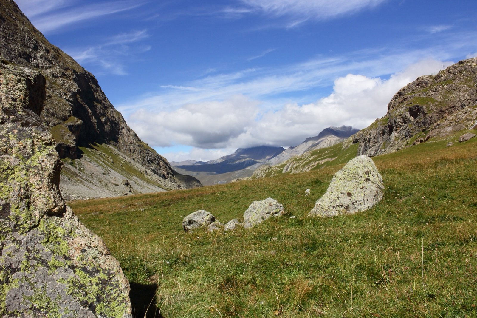
Écrins National Park
150 summits above 9,843 ft, crowned by the 13,458 ft Barre des Écrins.41 mi awayNational park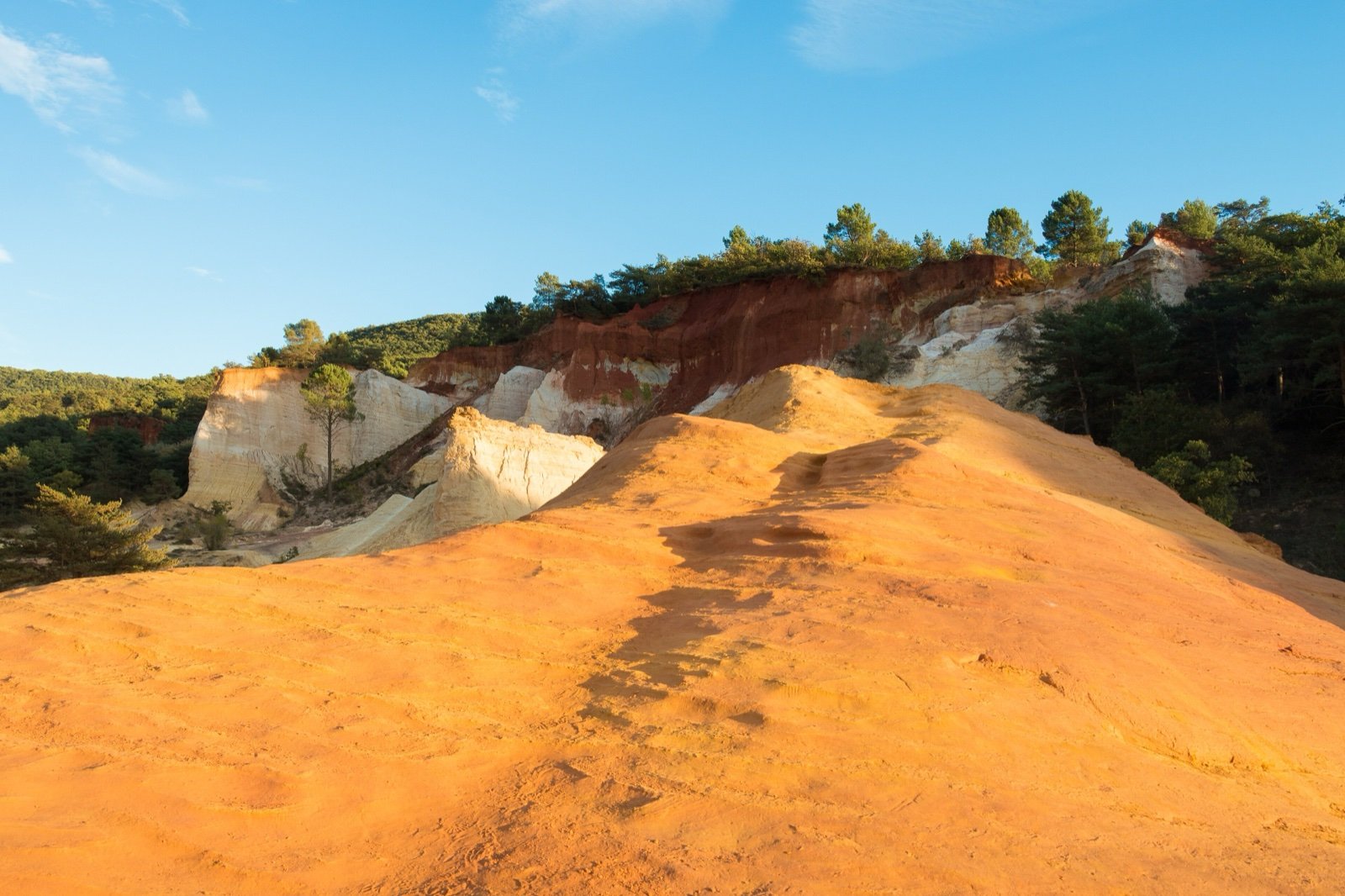
Luberon Regional Nature Park
28 fossil sites in a UNESCO Geopark of perched villages and ochre cliffs.72 mi awayRegional nature park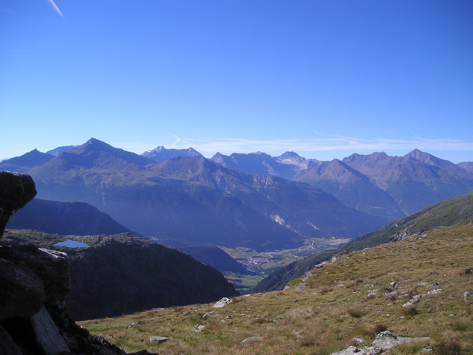
Vanoise National Park
1963: France’s first national park, created to save the ibex.74 mi awayNational parkSources
4 sources
- Parc naturel régional du Vercors consulted on October 16, 2026
- OpenStreetMap consulted on October 16, 2026
- Wikidata consulted on October 16, 2026
- Wikipedia consulted on October 16, 2026