Mercantour National Park
Eight valleys between Nice and the Ubaye, 40,000 rock engravings around Mont Bego, wolves and bearded vultures, and summits above 3,000 m only 50 km from the Mediterranean.
- 262 mi²Area
- 1,608 ft to 10,312 ftElevation
- 1979Established
At a glance
- About 40,000 rock engravings around Mont Bego, most dated to around 3,300 BC
- Highest point: the cime du Gélas, 3,143 m, only 50 km from the sea as the crow flies
- 78 mammal species, including France’s six wild ungulates and the wolf
- 2,067 plant species, about 42% of France’s native flora
- 1,700 km of waymarked paths, 550 km of them in the core, crossed by the GR5 and GR52
- Dogs are banned in the core, even on a lead or carried
Where to stay
Hotels, guesthouses and rentals around Mercantour National Park
Check availability with our partners
Affiliate links: if you book through them, we earn a commission. The price you pay does not change. How this site is funded
Run by the park
Refuge Hôtel de BayasseHotel
See the hotel
Mountain huts
Refuge de la Madone de Fenestre
6,243 ft · 62 beds
Other huts
- Refuge de la Cantonnière
- Refuge de la Cayolle7,434 ft
- Refuge de Valmasque
- Refuge des Merveilles
Nearest towns
BarcelonnetteClosest
26 mi as the crow flies
See hotelsNice
34 mi as the crow flies
See hotels
How the visit runs
Roya-Bévéra and the vallée des Merveilles 60 to 80 km from Nice
The Train des Merveilles (Nice-Cuneo) stops at Sospel, Breil-sur-Roya, Saint-Dalmas-de-Tende and Tende. From the lac des Mesches it is about 3 h on foot to the refuge des Merveilles, where guided visits start; Fontanalba is 2 h 15 from Castérino to the Lacs Jumeaux. The massif de l’Authion and the col de Tende complete the valley.
The Vésubie 50 to 70 km from Nice
Three high valleys: the glacial upper Gordolasque, the Madone de Fenestre, start of walks up to the Gélas, and the upper Boréon, with paths to the lac Nègre, the lac de Trécolpas and the Cougourde refuge. The summer Rando Bus runs from Nice to the Vésubie and the Gordolasque.
The Tinée 60 to 90 km from Nice
The fort de Rimplas, the first work built on the Maginot Line, the ouvrage de la Frassinéa, open for visits, and the lacs de Vens, between 2,286 and 2,327 m.
The Ubaye and the col de la Bonette 110 to 130 km from Nice in summer
The col de la Bonette is open only from about mid-May to mid-September; its viewpoint table reaches from Mont Viso to the 4,000 m peaks of the Écrins. The vallon du Bachelard follows the Route des Grandes Alpes up to the col de la Cayolle. In winter the drive from Nice grows to 230 km, and Barcelonnette is often reached via Digne-les-Bains.
Upper Var and Cians 80 to 100 km from Nice
The red gorges de Daluis, the village of Péone and its Demoiselles, and the col de la Cayolle above the hamlet of Estenc, where the Var rises.
The upper Verdon 120 to 130 km from Nice
Colmars-les-Alpes, a town fortified by Vauban, the forêt de Ratery, planted with 600,000 conifers from the end of the 19th century, and the lac d’Allos.
Four walks to the Mont Bego engravings
| Start | Approach | Walking time | Arrival |
|---|---|---|---|
| Lac des Mesches | From the Roya | about 3 h | Refuge des Merveilles, where guided visits start |
| Pont du Countet | From the Vésubie, by the pas de l’Arpette | 4 h | Refuge des Merveilles |
| Cabane de Tueis | From the Authion, by the pas du Diable (GR52) | 5 h | Refuge des Merveilles |
| Castérino | Into the Fontanalba valley | 2 h 15 | Lacs Jumeaux |
Source: Parc national du Mercantour, vallée des Merveilles page (read October 2026).
Before you go
- Bivouac: from 7pm to 9am, more than one hour’s walk inside the park boundary or from the last road access. Bivouac in a camper van, caravan or rooftop tent is forbidden.
- Merveilles and Fontanalba: stay on the marked paths, never walk on or touch the engravings, leave metal-tipped poles at home. Bivouac is banned across the engraving zone except in the areas beside the Merveilles and Fontanalba refuges.
- Fire is banned; self-contained stoves are allowed within prefectoral orders, more than 200 m from the edge of woods and forests.
- Guard dogs: keep your distance from a flock and its dogs, and walk round it when you can. Signs mark the busiest sectors.
- Mobile signal is missing across a good part of the core; the emergency number is 112.
- Weather: violent Mediterranean storms, mostly late in summer afternoons. Above 2,500 m, snowfields linger in June and some years into July, when crampons and an ice axe can help.
- Refuges: most are staffed, with varying opening periods. Book and check access; electricity is scarce, so do not count on charging a phone. The Cayolle and Cantonnière refuges are accessible to people with reduced mobility.
- Old munitions remain in the core (Authion, Maginot Line): do not touch, note the GPS position and alert the authorities.
- Waste, even biodegradable, goes back down to the valley; radios and speakers are banned in the core.
What is allowed
| Topic | Rule | Source |
|---|---|---|
| Wild camping (bivouac) | Restricted | Parc national du Mercantour |
| Camping | Not allowed | Parc national du Mercantour |
| Fires | Not allowed | Parc national du Mercantour |
| Dogs | Not allowed | Parc national du Mercantour |
| Drones | Not allowed | Parc national du Mercantour |
| Cycling | Restricted | Parc national du Mercantour |
| Motor vehicles | Restricted | Parc national du Mercantour |
| Picking plants | Restricted | Parc national du Mercantour |
| Fishing | Restricted | Parc national du Mercantour |
| Hunting | Not allowed | Parc national du Mercantour |
| Climbing | Restricted | Parc national du Mercantour |
| Scuba diving | Not allowed | Parc national du Mercantour |
Rules checked with the site manager on October 7, 2026. They can change at short notice: check before you go.
How to get there
Mercantour National ParkPlaces to stay in the parkGateway towns
- Nice1 h to 1 h 30 · 50 to 70 kmMercantour National Park
To the villages of the Vésubie (indicative times from the park).
- Nice1 h 30 to 2 h · 60 to 80 kmMercantour National Park
To the villages of the Roya and the Bévéra.
- Nice2 h 15 to 2 h 30 · 120 to 130 kmMercantour National Park
To the villages of the upper Verdon.
- Nice2 h 30 to 3 h · 110 to 130 kmMercantour National Park
To the Ubaye in summer. In winter the drive grows to 230 km and 4 h to 4 h 30, and Barcelonnette is often reached via Digne-les-Bains.
On 26 December 1859 Victor Emmanuel II created a royal hunting reserve on the Mercantour and Argentera massifs, and the park’s history starts there. The road to a national park took more than a century:
- 1860: after the Treaty of Turin, the Mediterranean side around Tende and La Brigue stays Italian.
- June 1940 and April 1945: the Authion is the scene of fighting.
- 20 November 1946: the Conseil général of the Alpes-Maritimes first calls for a park.
- 10 February 1947: the peace treaty; Tende and La Brigue had stayed Italian until then.
- 18 August 1979: decree no. 79-696, signed by Raymond Barre, makes the Mercantour the sixth national park in France, 33 years after the first call.
A park of 730 mi² that runs into Italy
The territory is 93 mi long, about two thirds in the Alpes-Maritimes and the rest in the Alpes-de-Haute-Provence. It splits into two zones:
- The core: 262 mi².
- The area of adhesion: 468 mi² across 24 communes, home to about 20,300 permanent residents (INSEE 2021).
- Along the frontier, nearly 21 mi of ridges shared with Italian Piedmont.
No physical border separates the park from Italy’s Alpi Marittime nature park, created in 1995: since 2013 the two have formed a European park (EGTC). The Mercantour is also twinned with Banff National Park in Canada.
Inside the core, the Roche Grande integral reserve at Entraunes, about 500 ha created on 4 September 2021, is left to evolve freely, with no human activity or presence allowed.
Limestone, crystalline rock and Mediterranean storms
The axis of the Tinée splits the park into two great massifs:
- To the north-west, a massif of limestone or schist.
- To the south-east, a crystalline massif shared with the Argentera.
The climate is alpine in the north and Mediterranean in the south. Winters average about 5 °C warmer than at the same altitude in the northern Alps, yet rainfall tops 1,000 mm a year and summer storms are frequent.
The landscapes change with the rock:
- In the upper Var, the red pelites of the gorges de Daluis earned them the nickname of the “Colorado niçois”.
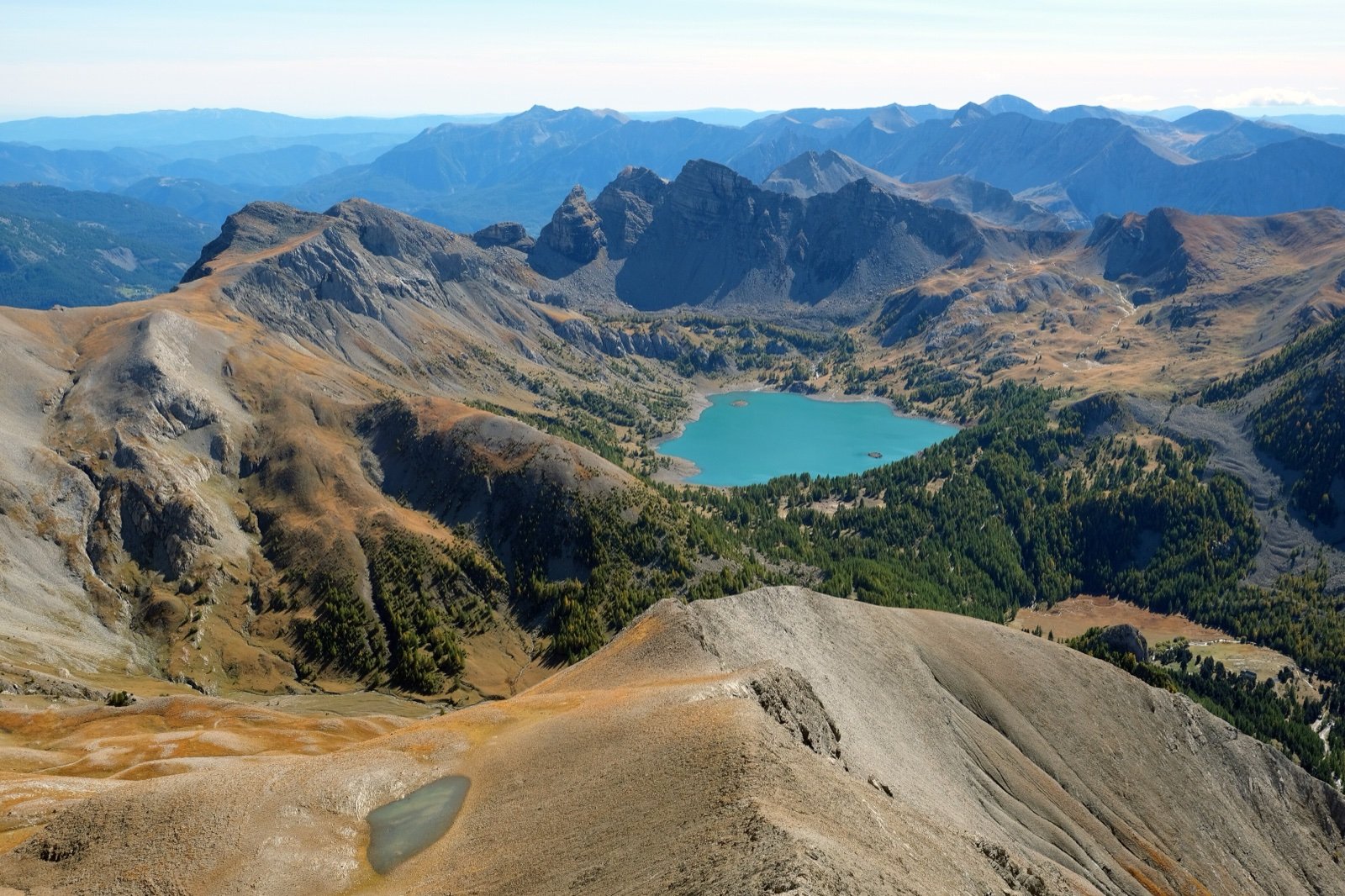
- Further west, the glacial lac d’Allos, at 7,310 ft under five towers of grès d’Annot and the mont Pelat (10,007 ft), is the largest natural lake in Europe above 7,218 ft.
Wolves, bearded vultures and 8,951 animal taxa
The park records 8,951 animal taxa, and in the core every animal species is strictly protected.
- Emblematic species: golden eagle, Alpine ibex, chamois, bearded vulture, griffon vulture, stoat, rock ptarmigan, grey wolf, marmot, black grouse, red deer and Mediterranean mouflon.
- Two endemics: Strinati’s cave salamander and the spider Vesubia jugorum.
- The wolf came back in 1992. Herders now guard their flocks with shepherds, night pens and livestock guard dogs (Pyrenean Mountain Dog or Patou, Anatolian Shepherd or Kangal, Spanish Mastiff), which walkers meet on the high pastures.
Feeding wildlife is a bad idea: the marmot is greedy, but human food can make it ill.
Plants and the night sky
The flora is just as rich: 2,067 confirmed plant species, more than half of the flora of the Provence-Alpes-Côte d’Azur region, with nearly a hundred endemic species in the broad sense, such as the potentille de Valdieri (Valdieri cinquefoil) in the upper Gordolasque.
At night, the Alpes Azur Mercantour international dark sky reserve, awarded in December 2019 and the 14th in the world, covers nearly 888 mi² and 74 communes, part of the core included, with more than 3,000 stars visible.
The engravings of Mont Bego
Around Mont Bego (9,423 ft, commune of Tende), the vallée des Merveilles and the Fontanalba valley hold about 40,000 rock engravings:
- on 4,000 rocks;
- between 1,900 and 8,858 ft;
- over 6.6 mi².
An order of the park’s director adds its own rules to those of the core, and access has tightened over time:
- 1989: the site is listed as a historic monument.
- 1999: free access to the engravings is limited to certain paths; elsewhere, only people led by an approved guide may enter.
- 2024: the public service concession for guided visits is renewed for five years.
- 2024 surveillance season: wardens issue 3,172 reminders of the rules, for metal-tipped poles, leaving the path, getting too close to the engravings and bivouacs.
Frequently asked questions
Are dogs allowed in Mercantour National Park?
No, not in the core, even on a lead or carried. Herding dogs, guide and assistance dogs are the exceptions. For a walk with a dog, the park recommends routes in the area of adhesion.
Can you wild camp in the Mercantour?
Camping is forbidden, but bivouac is allowed from 7pm to 9am, more than one hour’s walk inside the park or from the last road access. Staying several nights in one place without taking the tent down by day counts as camping.
Can you visit the vallée des Merveilles without a guide?
Yes, on certain paths only: since 1999 free access to the engravings is limited to them. Elsewhere you need an approved guide; guided visits leave from the refuge des Merveilles at fixed times, in groups of 15, for 2 or 3 hours.
How do you get to the Mercantour without a car?
By bus or train from Nice. Regular daily buses run from Nice, Monaco and Menton to each valley, the summer Rando Bus serves the Vésubie, the Gordolasque, the Tinée and the Cians, and the Train des Merveilles (Nice-Cuneo) serves the Roya valley. The Train des Pignes (Nice-Digne) does not reach the park but serves the lower Var and Verdon valleys, with a bus from Thorame to the Val d’Allos.
When is the col de la Bonette open?
From about mid-May to mid-September. Other passes and roads in the park also close in winter.
Are there wolves in the Mercantour?
Yes. The wolf returned in 1992 and is among the park’s emblematic species. Since then, herders protect their flocks with guard dogs that walkers meet on the high pastures.
Can you fly a drone in Mercantour National Park?
No. Drones are banned over the whole core, with exceptional waivers for authorised professional work, and motorised flight below 1,000 m above the ground is forbidden outside waivers for economic activity and rescue.
Can you paddleboard or dive in the Mercantour lakes?
No. Diving and navigation are both banned in the core, and paddleboards are among the offences the park reports.
Other protected areas nearby
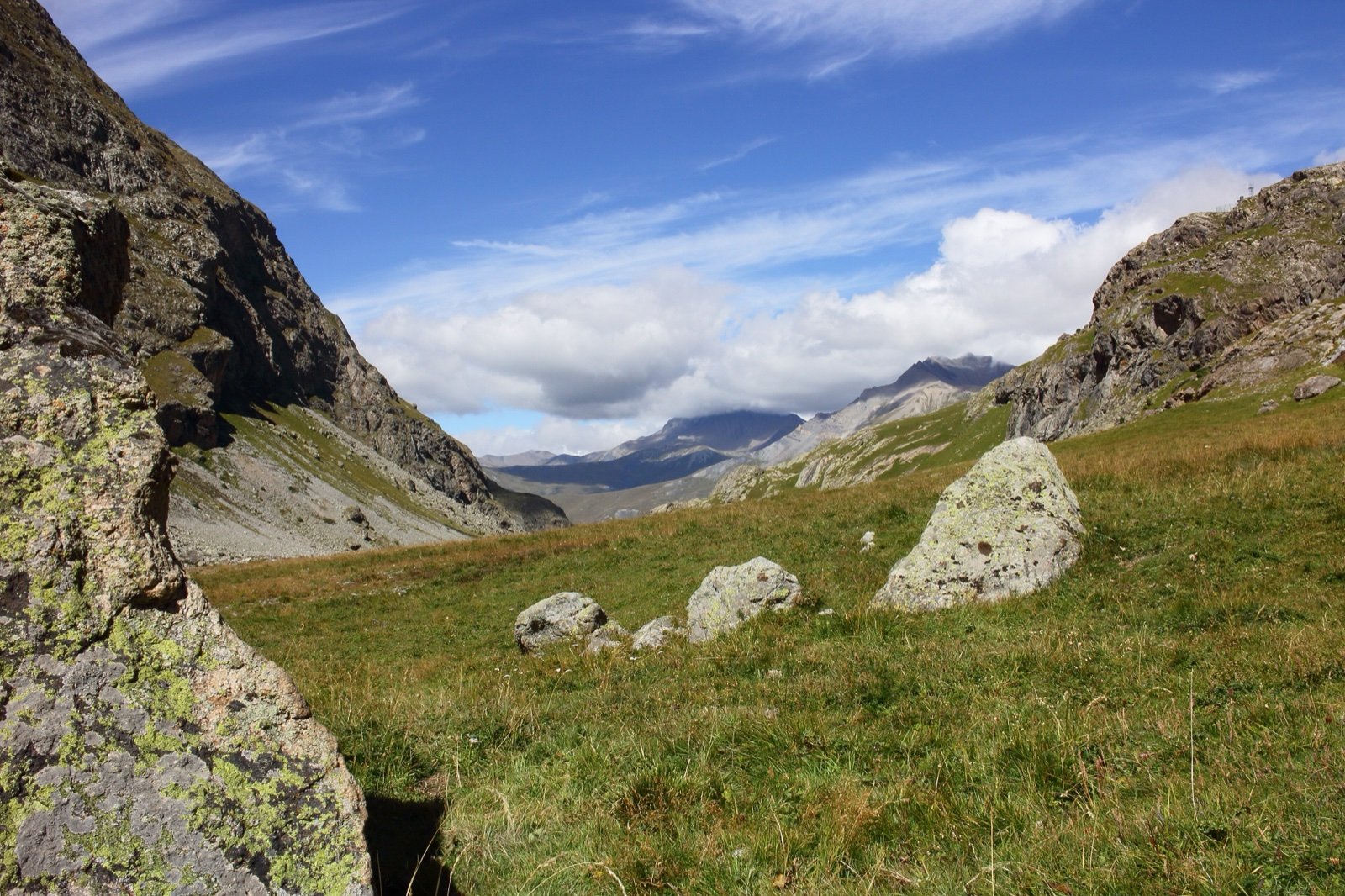
Écrins National Park
150 summits above 9,843 ft, crowned by the 13,458 ft Barre des Écrins.62 mi awayNational park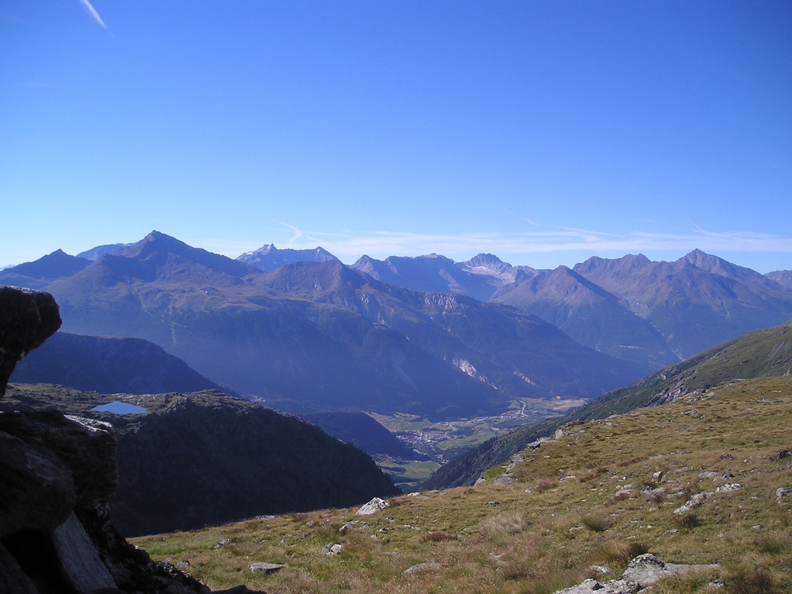
Vanoise National Park
1963: France’s first national park, created to save the ibex.82 mi awayNational park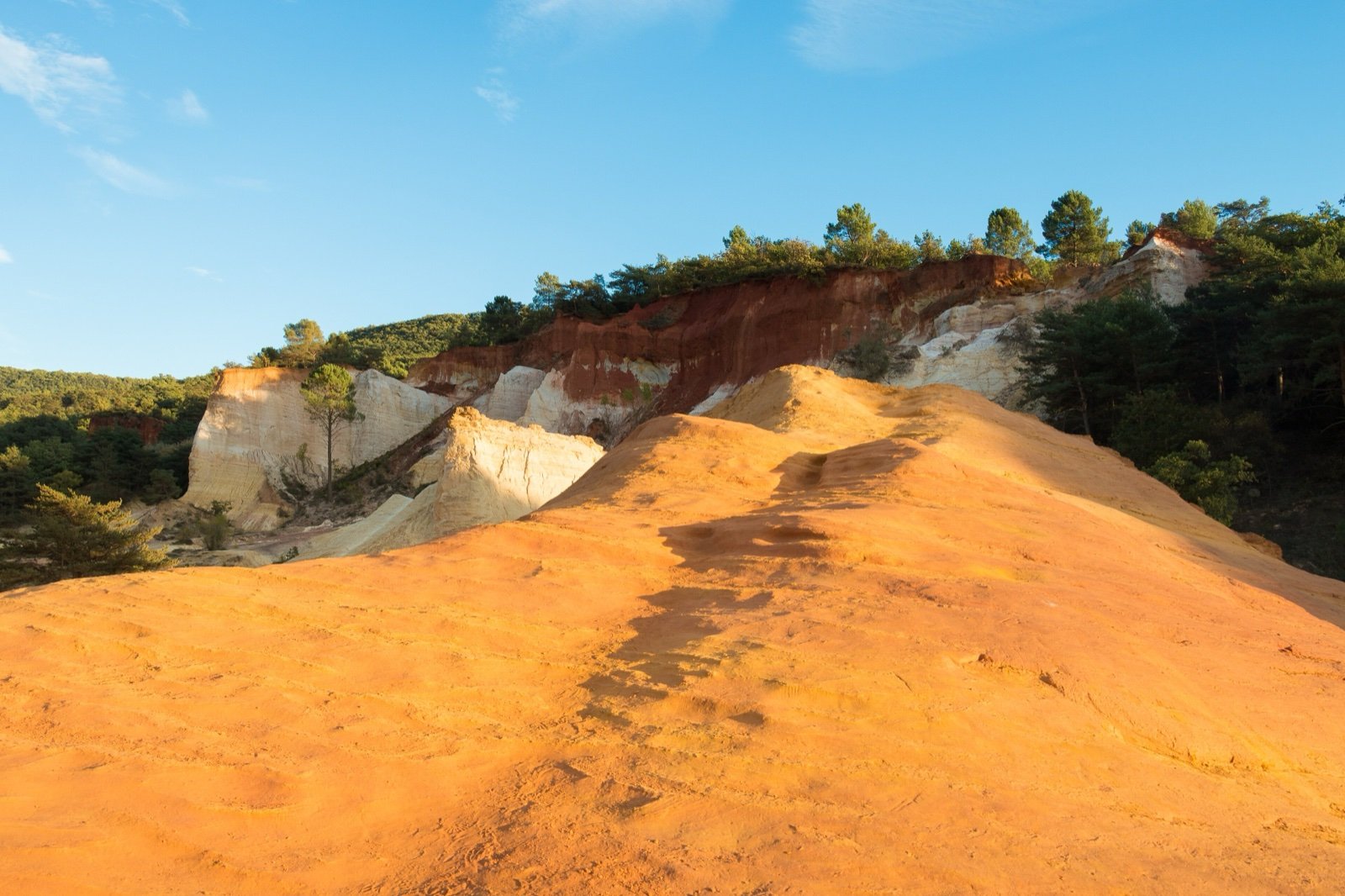
Luberon Regional Nature Park
28 fossil sites in a UNESCO Geopark of perched villages and ochre cliffs.86 mi awayRegional nature parkSources
8 sources
- Esprit parc national (Parcs nationaux de France) consulted on October 7, 2026
- Parc national du Mercantour consulted on October 7, 2026
- Atout France (France.fr) consulted on October 7, 2026
- OpenStreetMap consulted on October 7, 2026
- Wikidata consulted on October 7, 2026
- Wikipedia (de) consulted on October 7, 2026
- Wikipedia (en) consulted on October 7, 2026
- Wikipedia (fr) consulted on October 7, 2026