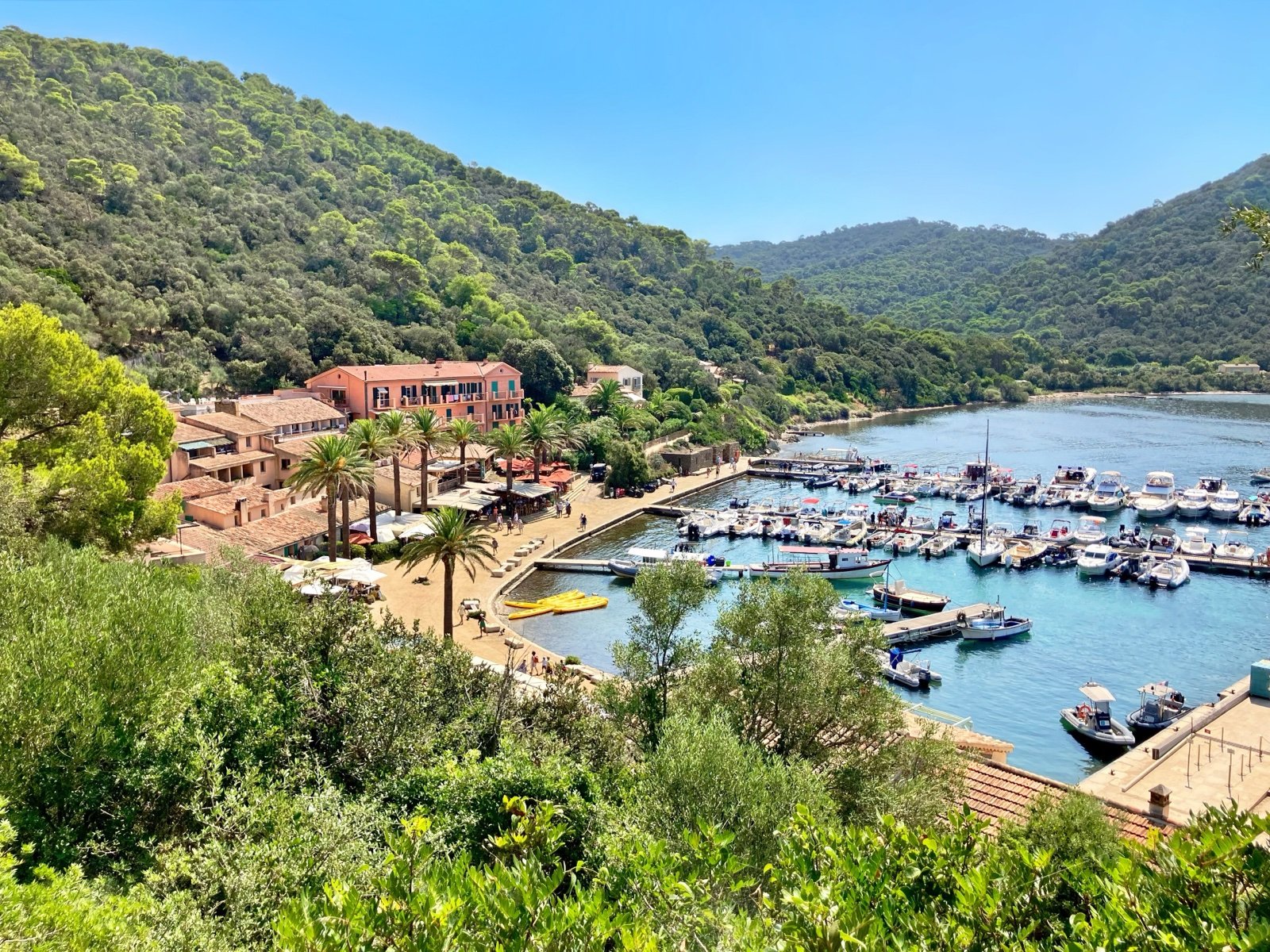
Port-Cros National Park
Port-Cros and the natural areas of Porquerolles, off Hyères, form the cores of what its manager calls Europe’s first marine park, with a protected strip of sea reaching 600 m around both islands.
- 18 mi²Area
- 1963Established
At a glance
- Created on 14 December 1963 and presented as Europe’s first marine park
- 4,600 ha of core: 1,700 ha on land and 2,900 ha at sea
- A protected marine strip reaching 600 m around Port-Cros and Porquerolles
- Port-Cros is visited on foot only; Porquerolles on foot and by bike
- No camping or bivouac in the cores, and no fire or cigarette outside the villages
- The park advises avoiding July and August to appreciate the islands
Where to stay
Hotels, guesthouses and rentals around Port-Cros National Park
Check availability with our partners
Affiliate links: if you book through them, we earn a commission. The price you pay does not change. How this site is funded
Nearby villages and towns
Le LavandouClosest
9.3 mi as the crow flies
See hotelsHyères
16 mi as the crow flies
See hotels
Larger cities further away
Toulon
25 mi as the crow flies
See hotels
How the visit runs
Port-Cros on foot
Boats leave from the port of Hyères and from Le Lavandou. The island is explored on foot, from the village to the vallon de la Solitude and the beaches of Port-Man, la Palud and the plage du Sud; la Palud also has an underwater trail.
Porquerolles by bike
The shortest crossing leaves from the Tour Fondue; boats also sail from Le Lavandou, Toulon and La Favière at Bormes-les-Mimosas. Paths lead to the beaches of the plage d’Argent, Notre-Dame, la Courtade and the Langoustier, and to the fort Sainte-Agathe and the church of Sainte-Anne.
The fort du Pradeau at the Tour Fondue
Listed as a historic monument and restored from 2020 to 2022, the fort du Pradeau is also a maison de Parc. The underwater trail of the pointe du Bouvet is at the Tour Fondue too.
The mainland: capes and underwater trails
On the coast, the park manages the natural areas of cap Lardier and cap Taillat for the Conservatoire du littoral, crossed by the sentier du littoral. Partner underwater trails include the baie du Niel at Hyères, the Olbia archaeological site and Pampelonne at Ramatuelle.
Port-Cros or Porquerolles: how each island is visited
| Island | Getting around | Dogs | Beaches named by the park | Maison de Parc |
|---|---|---|---|---|
| Port-Cros | On foot only | On a lead in the village only | Port-Man, la Palud, plage du Sud | Every day from 1 May to 30 September, 08:45 to 13:00 and 15:00 to 17:00 |
| Porquerolles | On foot and by bike (bikes marked from 1 July to 31 August) | On a lead on paths and trails, banned from the beaches | Plage d’Argent, Notre-Dame, la Courtade, the Langoustier | Tuesday to Saturday from 1 April to 31 October, 09:30 to 12:30 and 14:30 to 18:30; the fort du Pradeau at the Tour Fondue is also a maison de Parc |
Source: Parc national de Port-Cros, visit, beach and maison de Parc pages (read October 2026).
Before you go
- Water: there is no water point outside the villages of Port-Cros and Porquerolles.
- Fire risk: from 8 June to 20 September, a risk map is published every day at 18:00 for the next day. On red or extreme red days, the wooded massifs are closed and only a few tracks stay open; the Hyères-Risques app gives live updates.
- Dogs: on Port-Cros, on a lead in the village only, between the fort du Moulin and the statue of saint Joseph. On Porquerolles, on a lead on paths and trails, and banned from the beaches.
- Bikes: Port-Cros can only be visited on foot. On Porquerolles, from 1 July to 31 August, bikes must carry a marking that shows whether they are hired, brought over or belong to a resident.
- Scuba diving in the cores needs a free authorisation, valid for the calendar year and both islands, requested online on CaPeL; you then collect a sticker at a maison de Parc (Port-Cros, Porquerolles or the fort du Pradeau).
- Fishing: around Port-Cros, only trolling is allowed, more than 50 m from the coast, with two rods at most and one hook or lure per line. Spearfishing is banned. Around Porquerolles, coloured zones set what is free, authorised or forbidden.
- Anchoring is forbidden all year in the Bagaud zone (176 ha), which has 68 mooring buoys from 15 April to 15 October. Jet-skis and underwater drones are banned in the marine cores, except in an access channel at Porquerolles.
- Drones: flying over the cores is banned for every kind of aircraft, leisure drones included.
- Reduced mobility: the plage d’Argent on Porquerolles is the only beach equipped, with a wooden boardwalk to the sea, a tiralo beach wheelchair from 1 July to 31 August, toilets and a first-aid post. It lies 1.4 km from the port by a track, served by an electric taxi at set times.
What is allowed
| Topic | Rule | Source |
|---|---|---|
| Wild camping (bivouac) | Not allowed | Parc national de Port-Cros |
| Camping | Not allowed | Parc national de Port-Cros |
| Fires | Not allowed | Parc national de Port-Cros |
| Dogs | Restricted | Parc national de Port-Cros |
| Photography | Restricted | Parc national de Port-Cros |
| Drones | Not allowed | Parc national de Port-Cros |
| Cycling | Restricted | Parc national de Port-Cros |
| Motor vehicles | Not allowed | Parc national de Port-Cros |
| Picking plants | Not allowed | Parc national de Port-Cros |
| Fishing | Restricted | Parc national de Port-Cros |
| Hunting | Not allowed | Parc national de Port-Cros |
| Scuba diving | Restricted | Parc national de Port-Cros |
| Going ashore | Not allowed | Parc national de Port-Cros |
| Anchoring | Restricted | Parc national de Port-Cros |
| Visitor quota | Restricted | Parc national de Port-Cros, info presse |
Rules checked with the site manager on October 7, 2026. They can change at short notice: check before you go.
When to go
- Access restricted on some days June to September
- Busiest period July to August
How to get there
Port-Cros National ParkGateway towns
- Port of Hyères35 min to 1 hPort-Cros National Park
To Port-Cros, depending on the boat. A coach links Hyères station with the port Saint-Pierre.
- Le Lavandou30 minPort-Cros National Park
To Port-Cros direct, or 55 minutes via the Levant; boats also sail to Porquerolles in 50 minutes.
- Tour Fondue15 minPort-Cros National Park
To Porquerolles, the shortest crossing. A coach runs between Hyères station and the Tour Fondue.
- Toulon30 minPort-Cros National Park
To Porquerolles.
- Toulon-Hyères airport1 kmPort-Cros National Park
To the port of Hyères by taxi, the only means of transport available there.
Marceline Henry, who owned the western part of Port-Cros, gave almost all of her estate to the French state, 213 hectares, and the national park was created on 14 December 1963 with the support of André Malraux. Between the two world wars the island was a literary hub, linked to Saint-John Perse, Supervielle, Paulhan, Gide and Valéry.
In the 1630s Richelieu decided to protect the island against Barbary pirates by building three works:
- the Tour de l’Éminence;
- the fort de l’Estissac;
- the fort de Port-Man.
The island has also kept the fortin de la Vigie and the fort du Moulin, and historic sites such as the vallon de la Solitude and the manoir d’Hélène.
From one island to 138,000 hectares of land and sea
Porquerolles has been managed by the park since 1971 and became a core of the national park with the reform of 2012. The park is now made of three layers:
- Two cores: the island of Port-Cros and the natural areas of Porquerolles, each with a marine strip reaching 1,969 ft from the shore.
- An area of adhesion of 11,191 ha spread over five communes: Hyères, La Croix-Valmer, Le Pradet, Ramatuelle and La Garde.
- An adjacent marine area of 123,000 ha, running from La Garde to Ramatuelle and up to 3 nautical miles south of the islands.
About 350 people live year-round in the cores, against 99,000 in the area of adhesion. The park’s seat is in the garden of the Castel Sainte-Claire at Hyères.
Three islets off Port-Cros, Bagaud, la Gabinière and the rocher du Rascas, form an integral reserve of more than 61 ha created in May 2007: nobody may set foot there outside authorised scientific work.
The Îles d’Or (Golden Isles), an offshore piece of the Maures
Porquerolles, Port-Cros and the Levant extend the massif des Maures out to sea; rising waters cut them off from the mainland some 20,000 years ago. The two park islands differ:
- Porquerolles: 1,257 ha, about 4.3 mi long and 1.9 mi wide, five chains of wooded hills and long beaches of fine sand. It is the most inhabited and most farmed of the islands.
- Port-Cros: 700 ha and 2.8 mi by 2.2 mi, the smallest of the three, a mountainous island covered in dense forest.
The park also runs the Conservatoire botanique national méditerranéen on Porquerolles, and inventories count 602 land plant species and 500 species of algae in the park.
Groupers, Posidonia and the Pelagos sanctuary
The park sums itself up as the place where the grouper is king and the Posidonia flowers: this seagrass forms vast underwater meadows. The marine inventories, given as indicative because they are still in progress, list:
- 180 species of fish;
- 265 of crustaceans and 173 of molluscs;
- 92 of sponges and 53 of echinoderms;
- 3 of marine reptiles and 8 of cetaceans.
On land the figures are smaller: 12 mammal species, 7 of them bats, 177 bird species of which 26 nest, 6 reptiles and 2 amphibians. Two of them are endemic to the Îles d’Or, the European leaf-toed gecko and the Tyrrhenian painted frog. The booted eagle, the yellow-legged gull and the peregrine falcon nest on Port-Cros. Winter mimosa and water hyacinth, two invasive species, are followed by the ALIEM programme.
At sea the park carries several international roles:
- 1999: it starts coordinating the French part of the Pelagos sanctuary for marine mammals, shared by France, Monaco and Italy.
- 2001: it becomes the first French Specially Protected Area of Mediterranean Importance (SPAMI); it is also a founding member of MedPAN.
Three Natura 2000 sites lie at sea: the Rade d’Hyères, the Îles d’Hyères and the Corniche varoise; the Îles d’Hyères special protection area covers 47,905 ha, 94% of it marine.
Six thousand visitors a day on Porquerolles
The park puts its attendance at two million visitors a year, one of the highest among France’s eleven national parks, in a department, the Var, that ranks as the second tourist destination in France. About a dozen boat companies serve Porquerolles.
The park puts the island’s carrying-capacity threshold at about 6,000 visitors landed per day: beyond it, the share of dissatisfied visitors rises from 24% to 48%. To keep below it:
- The boat operators outside the public service contract have signed a charter committing them to keep the passengers they carry to Porquerolles to no more than 6,000 a day.
- The public service contract renewed in March 2021 regulates crossings during the summer periods concerned.
- The park developed alerts on Waze for heavy traffic on the presqu’île de Giens, and an app for boaters, Nav’Co.
Frequently asked questions
How do you get to Port-Cros island?
By boat: from the port of Hyères in 35 minutes to an hour depending on the boat, or from Le Lavandou in 30 minutes direct or 55 minutes via the Levant. A coach links Hyères station with the port Saint-Pierre in Hyères.
How do you get to Porquerolles?
By boat, in 15 minutes from the Tour Fondue, 30 minutes from Toulon or 50 minutes from Le Lavandou; boats also leave from La Favière at Bormes-les-Mimosas. A coach runs between Hyères station and the Tour Fondue.
Can you camp on Port-Cros or Porquerolles?
No. Camping and bivouac are forbidden in the cores of the park, and on cap Lardier and cap Taillat the manager states that even a bivouac is strictly forbidden.
Are dogs allowed on Port-Cros and Porquerolles?
Only on a lead, and not everywhere. On Port-Cros dogs are allowed in the village only; on Porquerolles they stay on a lead on paths and trails and are banned from the beaches.
Do you need a permit to dive at Port-Cros?
Yes, for scuba diving: the authorisation is free, valid for the calendar year and for both islands. Dive sites cited by the park include the Gabinière islet, the pointes du Vallon and de la Croix, and the wrecks of the Donator and the Grec.
Can you fly a drone in Port-Cros National Park?
No. Overflight of the cores is banned for every aircraft, leisure drones included, and motorised flight below 1,000 m needs a waiver from the park’s director.
When is the best time to visit Port-Cros National Park?
Outside July and August, as the park advises, to appreciate the sites. The manager also says both islands are best discovered outside the summer season, when the risk of fire is high.
Other protected areas nearby
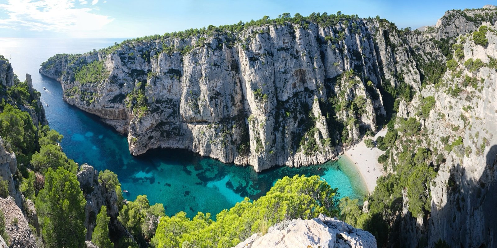
Calanques National Park
White limestone coves between Marseille and Cassis, reached on foot.50 mi awayNational park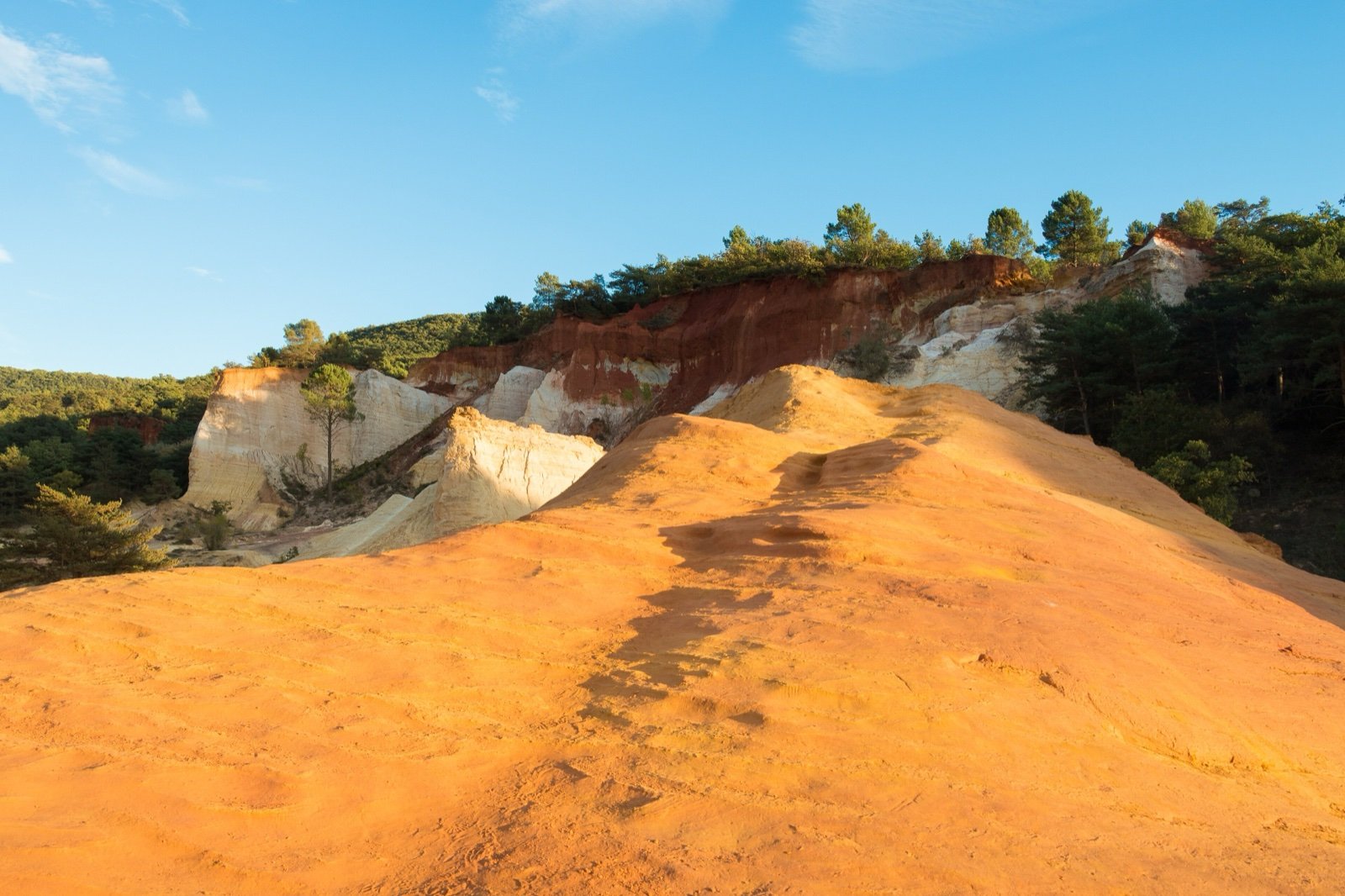
Luberon Regional Nature Park
28 fossil sites in a UNESCO Geopark of perched villages and ochre cliffs.78 mi awayRegional nature park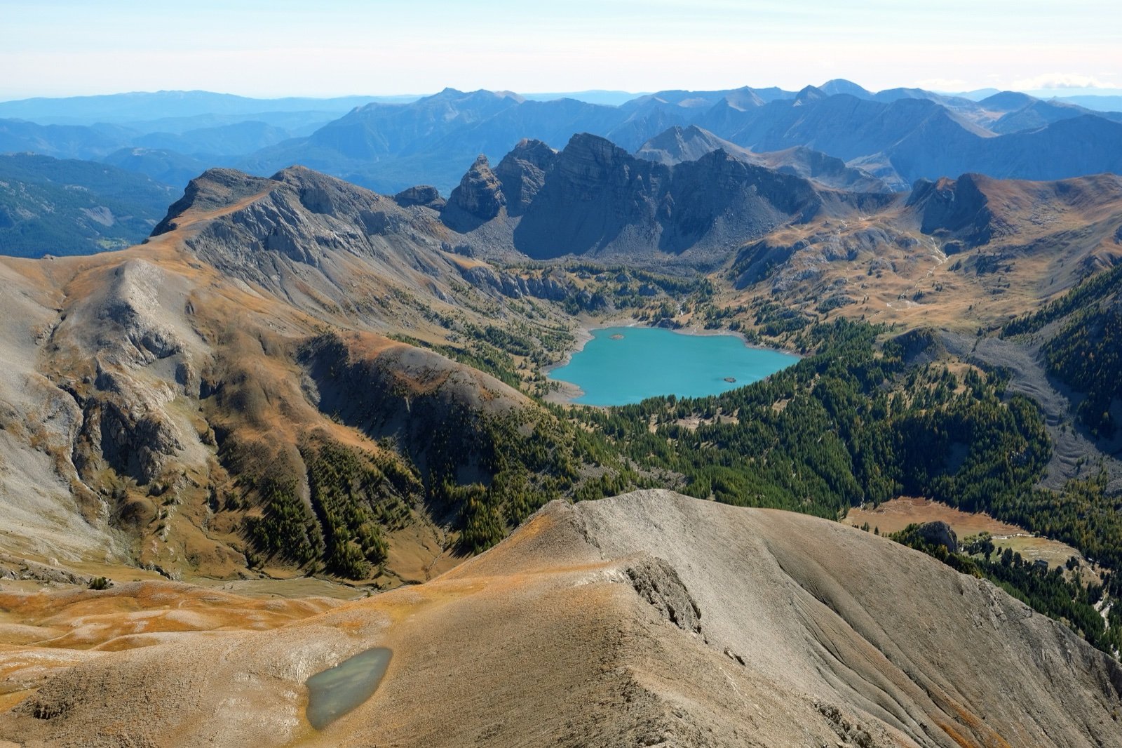
Mercantour National Park
40,000 rock engravings around Mont Bego, from about 3300 BC.87 mi awayNational parkSources
7 sources
- Esprit parc national (Parcs nationaux de France) consulted on October 7, 2026
- Parc national de Port-Cros consulted on October 7, 2026
- Parc national de Port-Cros, info presse consulted on October 7, 2026
- Atout France (France.fr) consulted on October 7, 2026
- OpenStreetMap consulted on October 7, 2026
- Wikidata consulted on October 7, 2026
- Wikipedia consulted on October 7, 2026